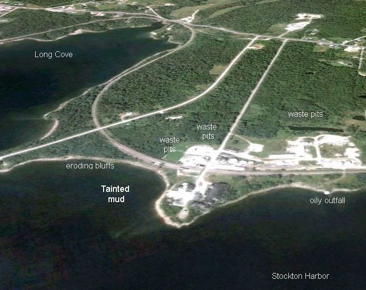

We started at the parking lot - the white spot at the end of the aerial pic's Sears Island Road. We walked along the eroding bluffs and around the "point" of Kidder Point past the facility and its outfall pipes and discontinued ammonia pipe offshore dock near the mouth of Stokcton Harbor to the (formerly) oily outfall, then back. The tide wasn't far enough out to sample the tainted mud that time.
Photo album created with Web Album Generator